Traveling down North Sherman Boulevard will become a different experience in a few years, and your input can help shape its future.
Workers from the City of Milwaukee, Wisconsin Department of Transportation and design firms are asking residents what they would like to see incorporated in the boulevard’s design.
They are planning a full reconstruction of a two-mile stretch from West North Avenue to West Capitol Drive. Construction is scheduled to start in 2026.
Here are some things you should know:
A focus on safety
This reconstruction provides an opportunity for the engineers to improve Sherman Boulevard’s pavements and to make modifications to the corridor’s overall design.
These efforts are intended to increase safety for cars, pedestrians and bicyclists while preserving the existing environment.
Getting feedback from the community
On Aug. 23, the North Sherman Boulevard Project hosted an open house in the Mary Ryan Boys & Girls Club of Greater Milwaukee to present some initial data and gather community thoughts.
“We don’t have anything proposed yet,” said Will Barrett, a transportation designer with Graef, one of the firms consulting on the project. “It’s really just about getting everybody’s input.”
Who’s paying for the project?
The North Sherman Boulevard Project is 80% federally funded through the Surface Transportation Program – Urban grant and 20% by the city. It’s estimated to cost $20 million to $25 million.
What will the project do?
The project plans to completely reconstruct the whole corridor’s pavement and base, curb and gutter, Americans with Disabilities Act pedestrian ramps, sidewalks, street lighting, traffic signals and some drainage structures.
North Sherman Boulevard has four lanes of traffic along with center medians and outer lanes usually marked for parking. That means it has a lot of space for additional design changes to become a “complete street” that has accommodations for all types of travelers.
“As an engineer, what we’re looking at is: What can we do to bring in safe bicycle accommodations? What can we do to make it more desirable for pedestrians and bicyclists? How do we reduce some of the speeding and some of the crashes and the reckless driving that we see out there?” said David Tapia, major projects manager of the Department of Public Works.
Speed and "complete streets"
Representatives from the project’s two primary engineering consulting firms, Strand Associates and Graef, shared posters of preliminary data about the Sherman corridor at the meeting.
From 2017 to 2021, there were 990 crashes on Sherman Boulevard, 68% at intersections with signals, according to the data.
Speeds from 78 mph to 87 mph were tracked at different intersections within the 30 mph speed limit.
The team is evaluating the speed limit and getting feedback to try to meet the goal of calming traffic and reducing reckless driving.
What bikers should know
Owen Driscoll, 16, attended the meeting because he wants to be able to bike on North Sherman Boulevard to and from Rufus King High School instead of driving every day.
“When I started driving, my mom was all like: ‘Oh, go the speed limit,’” Driscoll said. “And now she’s like: ‘You better be going 37 on Sherman or you’re gonna get rear-ended.’”
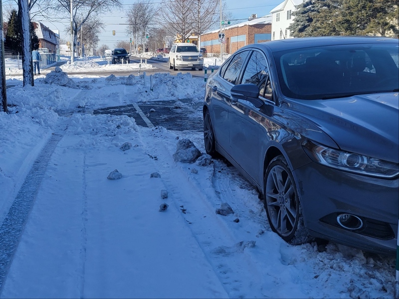
On- and off-street bike accommodations are being considered for the boulevard, including taking the parking lane or the outside lane of traffic and creating a protected or raised track for bikes or using a “flex lane” that can change from parking to bike lanes.
Traffic, traffic, traffic
About 19,200 cars on the north end travel daily past West Roosevelt Drive and 26,100 vehicles per day travel along West North Avenue, according to the preliminary data.
The traffic volume numbers will be analyzed to figure out if there is a way to reduce the number of lanes.
Historical districts on Sherman
To preserve the many historic properties and districts along Sherman Boulevard and minimize impacts to existing trees, a consulting firm will help the project avoid changes that have adverse effects.
What some community leaders say they want
Mabel Lamb, executive director of the Sherman Park Community Association, said she would like to see gateway markers added so people know they are entering Sherman Park and to show it is historic.
“I would like to see a focus and an effort on making sure that this project is inclusive of all people,” Lamb said.
She explained that she hopes the project uses diverse businesses and engages residents who might not have internet access or not be able to come to public meetings.
What’s next?
After they gather community input and finalize a traffic report, the project team will develop multiple designs that they will present to the community at the next public information meeting, tentatively scheduled for November or early next year.
How to give feedback
You can learn more about the project and get in touch with its public involvement team at its website, improveshermanblvd.com/, or by contacting (262) 853-0350 or shermanblvd@milwaukee.gov.
Residents can also pin comments to specific points on the project area’s map and take surveys at the Social Pinpoint website.
For businesses on the Sherman Boulevard corridor, the city’s Support for Business Program has resources on preparing for and operating during construction.


